

Crésuz-Gruyères par les gorges de la jogne
Suggestions
- famille
- agriculture
- mobilité
- énergie
- tourisme
- faune
- biodiversité
- vélo
- patrimoine
- randonnée
- produit
- alpage
Itinerary
Export GPX
état du chemin
Suite à des nombreux dégâts survenus durant l'hiver, les Gorges de la Jogne sont fermées pour une durée inderminée. Des travaux devraient être entrepris.
L'état des chemins peut varier en tout temps. Veuillez consulter SuisseMobile avant de partir en randonnée.
Il est toujours possible de relier Crésuz à Gruyères par Châtel-sur-Montsalvens.
SMARTPHONE app
The free Cheese trails app lets you follow the cheese trail Le Gruyère AOP and the cheese trail L'Etivaz AOP itineraries with all the information in your pocket! It lists and provides information on :
- the stages (maps, stage descriptions, journey times, etc.)
- points of interest (museums, monuments, curiosities, etc.)
- various options for eating out
- accommodation
Points of interest

Jogne Gorge
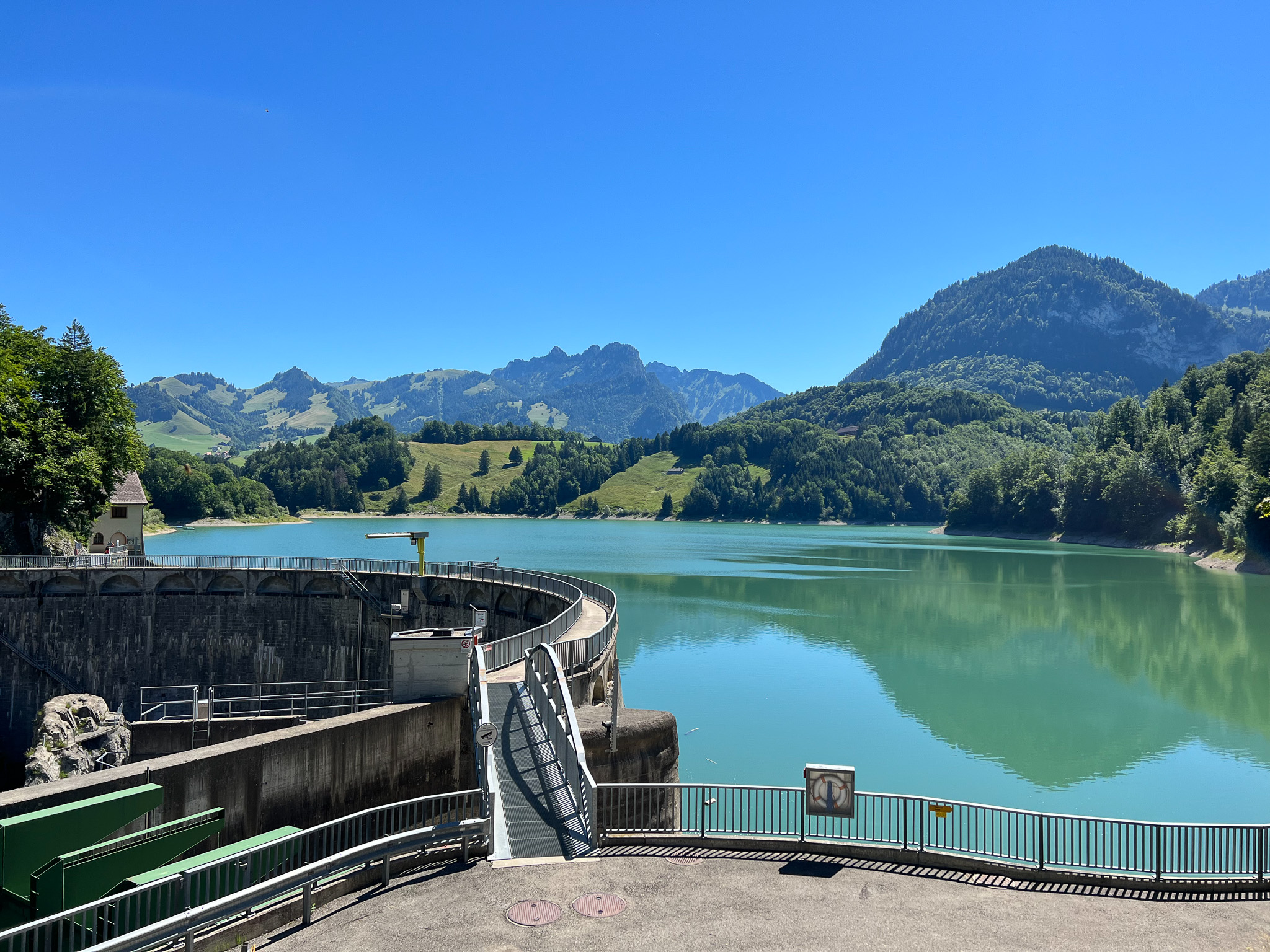
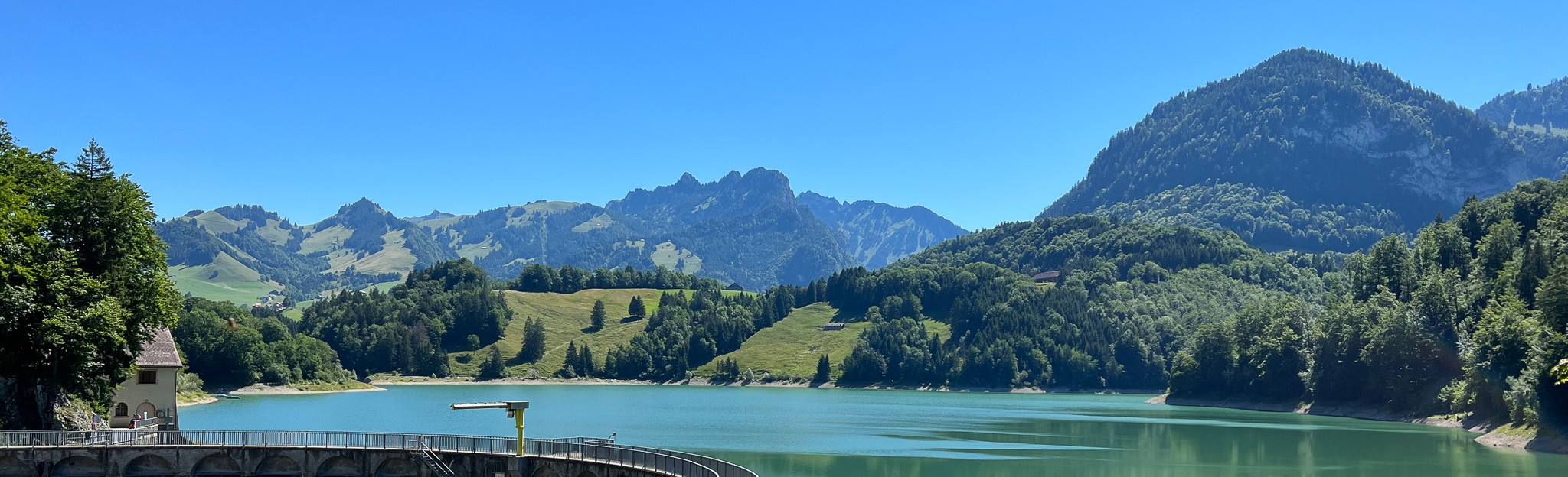
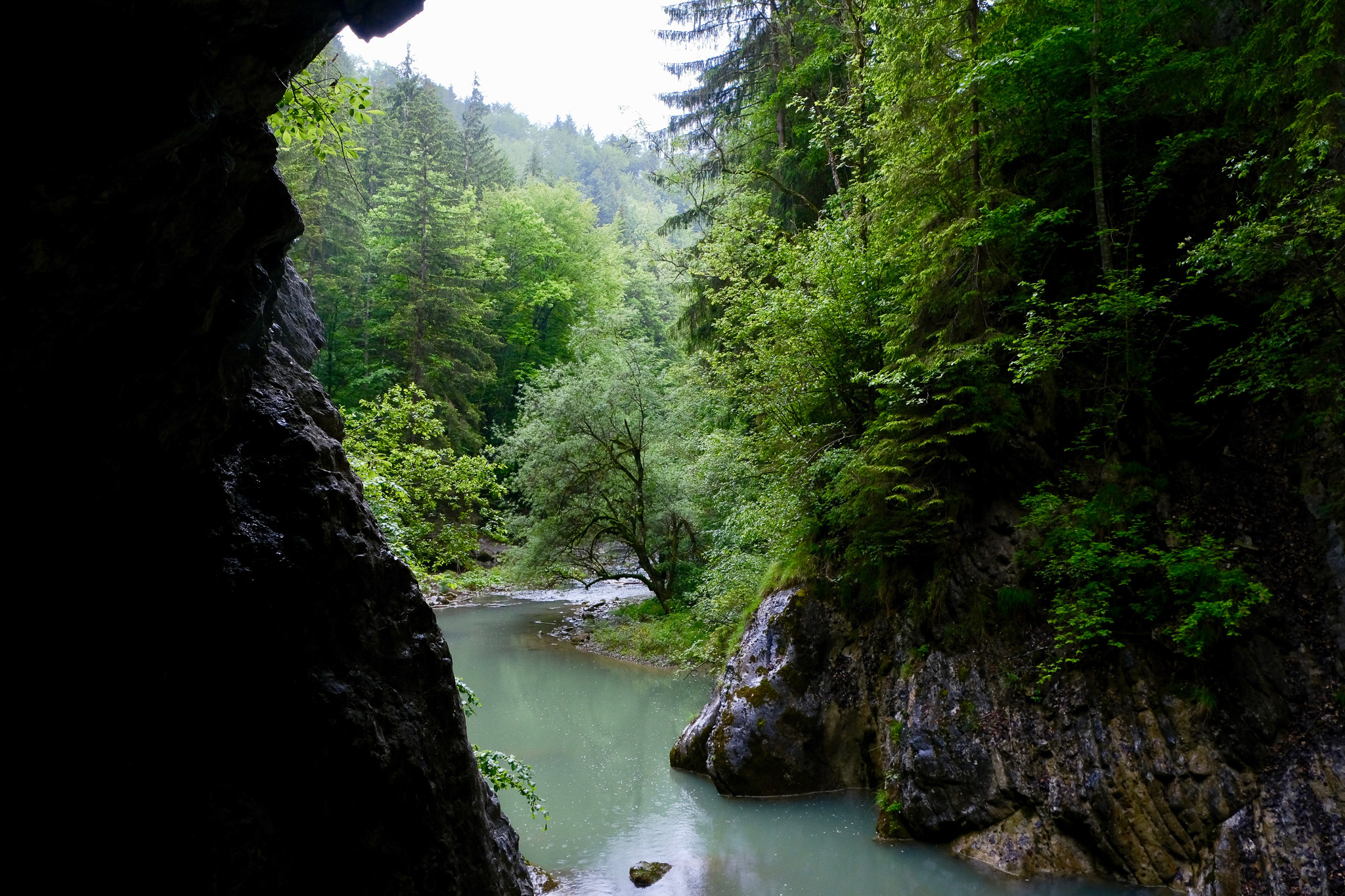
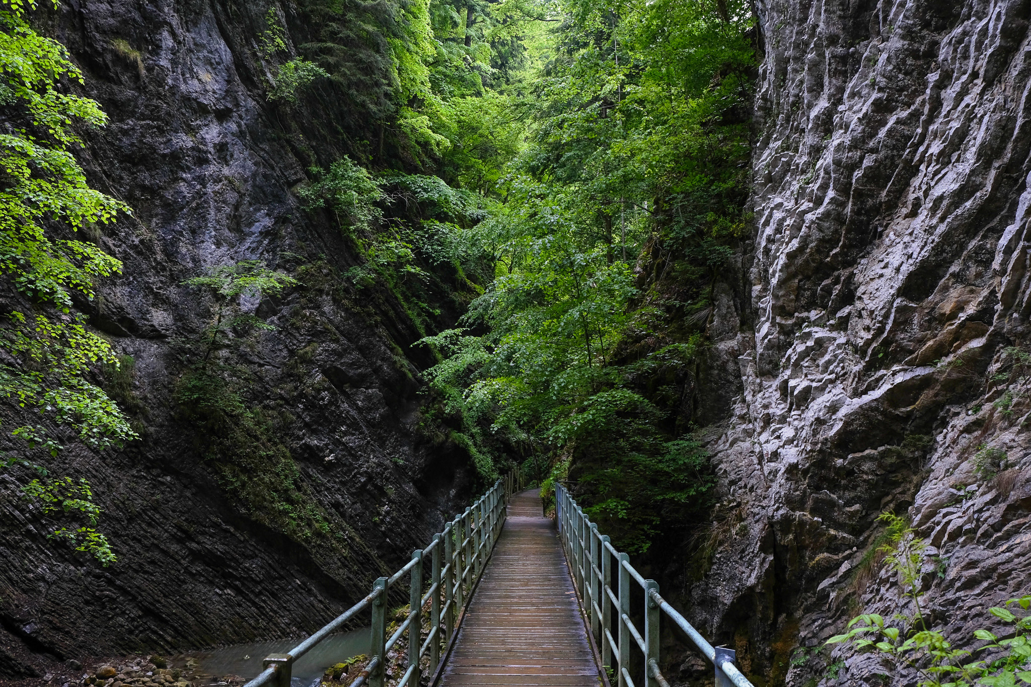
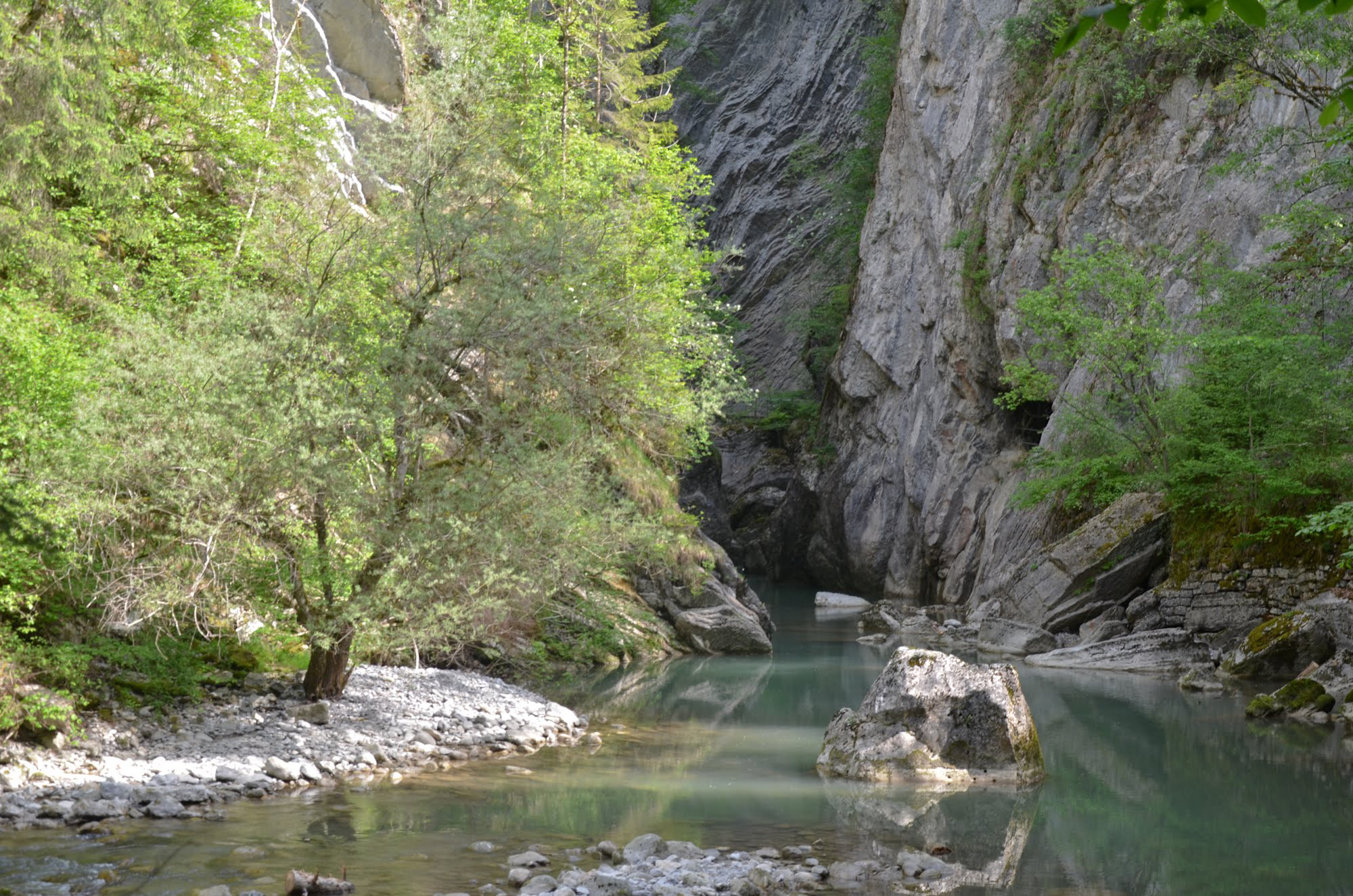
The Jogne Gorge is a deep gash in the Earth sculpted by underground stream systems. The gorge links the Jogne Valley, at 800 m altitude, to the Sarine Valley, about 100 meters below. About 2 km long, the gorge is very narrow, with steep vertical sides, at times towering over 100m high. A variety of rock formations dating to the Jurassic period are particularly visible. Jogne Limestone, rather resistant to erosion, forms the narrowest passage of the gorge, where tunnels and bridges have been built to allow hikers to navigate the gorge on foot. Today, the flow and dynamic of the Jogne River have been altered by the presence of Montsalvens Dam. High water periods are artificial and depend on the workings of hydroelectric installations. A portion of the stocked water in the retention lake is diverted into the conduit turbines of Broc-Fabrique to produce electricity. The water then returns to the river downstream of the gorge.
Gorges de la Jogne
1653 Châtel-sur-Montsalvens

Montsalvens Dam
This dam, located along the Jogne river, is responsible for Montsalvens lake. Built between 1918 and 1921 by engineer Heinrich Eduard Gruner, it was the first arch dam in Europe with both horizontal et vertical curves. 52m high and 110m long, its construction required 26’000 m3 of concrete.
1636 Châtel-sur-Montsalvens
Find a wide selection of points of interest, accommodation and catering options on the free Cheese Trails app.