Landscape
Suggestions
- famille
- agriculture
- mobilité
- énergie
- tourisme
- faune
- biodiversité
- vélo
- patrimoine
- randonnée
- produit
- alpage
GEOLOGY AND GEOMORPHOLOGY
The Pre-Alps, where the Gruyère Pays-d’Enhaut Park lies, form a geological unit clearly distinct from the Alps. They consist of a complex interweaving of different sedimentary layers and tectonic slices. The nature of the rock and the orientation of the layers determine the landscapes and vegetation found here.
Most of the Park’s territory lies on the Median Pre-Alps nappe. It also includes areas belonging to the higher nappes of La Brèche, the Niesen, and the sub-median zone (in Les Mosses). The Median Pre-Alps nappe consists of two entities: the plastic Median Pre-Alps, which have folded (e.g., the Vanils chain), and the rigid Median Pre-Alps, which fractured into slices under the pressure of the Alps (e.g., the Gummfluh, the Gastlosen).
The higher nappe, or Simme nappe, is composed of flysch — soft, relatively impermeable rocks — which create a more rounded and undulating landscape (e.g., Rodomonts), with numerous wetlands and bogs. The Niesen nappe is also made up of coarser, conglomerate-dominated flysch, found for example at Tornettaz, Pic Chaussy, and part of the Col des Mosses.
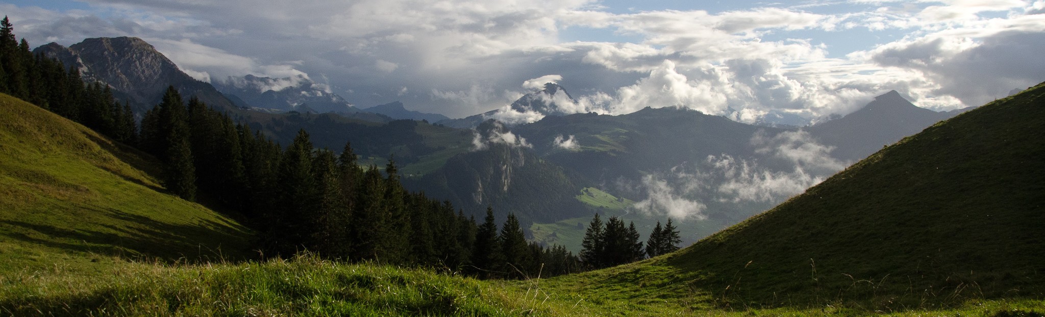
The backbone of the landscape is defined by the alignment of eight mountain ranges:
- La Berra
- The chain Rochers-de-Naye – Dent de Corjon – Pointe de Cray – Vanils chain
- The chain Pointe d’Aveneyre – Planachaux – La Laitemaire – Rochers des Raes
- The chain Tour d’Aï – Mont d’Or – Rochers du Midi – Rübli
- The chain Chaussy – Wittenberghorn
- Moléson – Dent de Lys – Cape au Moine
- The Gastlosen
- Gros Brun – Kaiseregg
Glacial processes have profoundly shaped the landscape through erosion, transport, and deposition. By abrasion and plucking, glaciers carved valleys (such as the Torneresse valley near L’Etivaz). Morainic deposits from the Rhône glacier have created a few limestone-free zones where chestnut groves can be found.
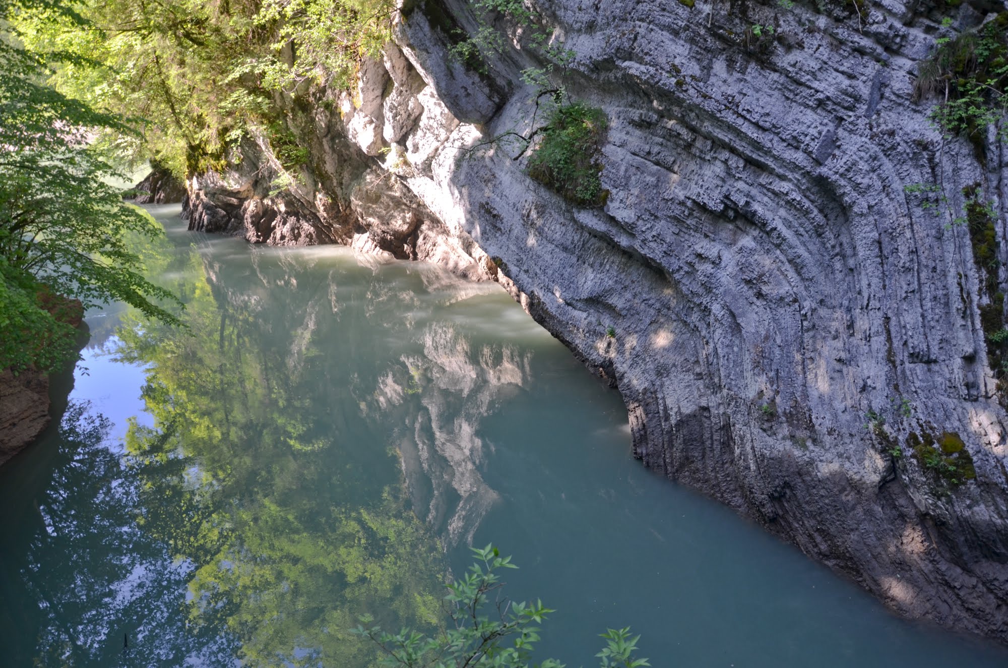
Complete torrential systems are common. From upstream to downstream, they feature a retention basin, a flow channel, and, where the slope decreases, an alluvial fan. The village of Lessoc is built on an inactive alluvial fan. Erosion from fluvial processes has cut gorges and cluses into the rock, as seen at La Tine, in the Pissot gorges, and in the Jogne gorges. In areas with gentle slopes, alluvial plains can also be observed, with a minor bed (carrying water year-round) and a major bed (linked to flood events).

DIVERSITY OF NATURAL LANDSCAPES


Marshland sites and landscapes, numerous raised and low bogs, alluvial zones, dry meadows and pastures… The Park boasts a remarkable diversity of landscapes. This is confirmed by four federal landscape inventories (IFP).
- Vanil Noir: a characteristic region of the northern limestone Pre-Alps, featuring rocky cliffs and a remarkable, rich, and typical mountain, subalpine, and alpine flora, notable for its glacial and post-glacial relics, the arolla pine forest of Lapé, and the maple woods of Morteys.
- La Pierreuse – Gummfluh – Vallée de l’Etivaz: a mountainous area comprising several valleys dominated by high limestone walls, with subalpine and alpine vegetation including remarkable grasslands, low bogs, and tall-herb meadows.
- Tour d’Aï – Dent de Corjon: a characteristic landscape of the northern limestone Pre-Alps, rising from the plain to the alpine zone. The highly varied vegetation displays the succession of all forest stages. The Bois de La Latte offers a rare example of an arolla pine stand on limestone, exceptionally rich in plant species.
- Breccaschlund: a funnel-shaped glacial valley divided into several compartments with no surface drainage. This pristine landscape is marked by numerous moraine ridges, scree slopes and debris, karst formations, and scattered maples dotting the pastures. The flora is typical of the limestone Pre-Alps.
This diversity results from the meeting of two climates in the northwestern Pre-Alps: the humid Atlantic climate and the dry continental climate of the central Alps. These two climatic influences have a strong impact on vegetation, enabling a wide variety of species to thrive. The varied relief — cliffs, scree slopes, and more — further adds to this diversity, providing habitat for the richest calcicolous flora typical of the northwestern Alps.
HISTORICAL AND CULTURAL ASPECTS OF THE LANDSCAPE
Shaped by a thousand years of farming, the Park’s landscapes bear witness to a long-standing pastoral and cheese-making economy.
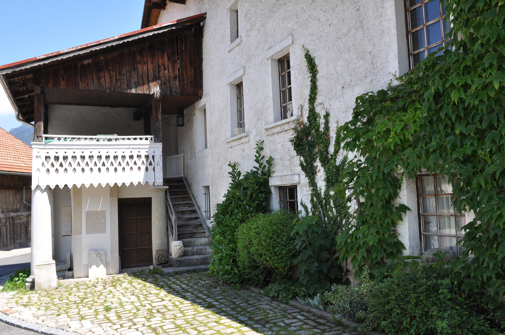
From the 15th century onwards, the pastures of Haute Gruyère were increasingly used for expanding cheese production. The golden age of this “Gruyère civilisation” came in the 17th and 18th centuries, with cheese exports abroad. The establishment of a cheese monoculture would leave a lasting mark on the landscape, first through the clearing of mountain forests to extend alpine farming.
The thriving cheese trade also influenced the built heritage. Merchants — known as the “cheese barons” — commissioned large buildings with generously proportioned spaces and finely decorated façades. At the same time, transport routes linking Pays-d’Enhaut and Gruyère to Lake Geneva (and the wider European market) were expanded and improved.